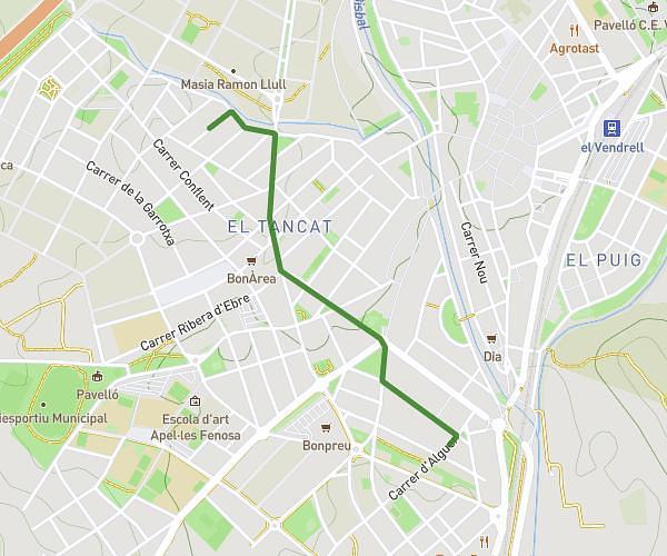
This walking route covers 6.712mi starting from Torredembarra, Tarragona. The walk does not return to the trailhead and ends near Carrer Fondo 3, 43762 La Riera de Gaià, Tarragona, Spain. This walk is rated as hard, plan for about 2h24m to complete it. The route has an elevation gain of 600ft and an elevation loss of 551ft.
st simplici
Route details
21:27/mi
Pace
588 kcal
Calories burned
Point to point
Route type
46ft
Min altitude
315ft
Max altitude
Route profile
600ft
Elevation gain
551ft
Elevation loss
46ft
Min altitude
315ft
Max altitude
How to get there
Trailhead: Plaça De La Font 10, 43830 Torredembarra, Tarragona, Spain
GPS coordinates of the trailhead: 41.144447, 1.396926 / 41°8'40'' N, 1°23'48'' E