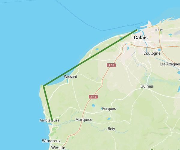
This walking route covers 7.204mi starting from Calais, Pas-de-Calais. The walk is a loop trail and returns to the trailhead. This walk is rated as hard, plan for about 2h34m to complete it. The route has an elevation gain of 177ft and an elevation loss of 180ft.
Entraînement
Route details
21:30/mi
Pace
633 kcal
Calories burned
Loop trail
Route type
-7ft
Min altitude
26ft
Max altitude
Route profile
177ft
Elevation gain
180ft
Elevation loss
-7ft
Min altitude
26ft
Max altitude
How to get there
Trailhead: 117 Rue Roger Bissière, 62100 Calais, France
GPS coordinates of the trailhead: 50.9494, 1.885664 / 50°56'57'' N, 1°53'8'' E