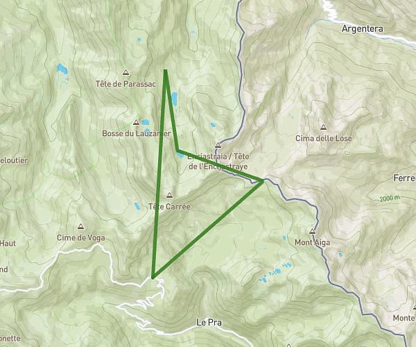
This hiking trail covers 11.401mi starting from Saint-Étienne-de-Tinée, Alpes-Maritimes. The hike is a loop trail and returns to the trailhead. This hike is rated as strenuous, plan for about 8h39m to complete it. The route has an elevation gain of 3871ft and an elevation loss of 3865ft.
Lacs de Vens
Route details
1.32mph
Speed
4022 kcal
Calories burned
12.9%
Avg grade
Loop trail
Route type
5407ft
Min altitude
8524ft
Max altitude
High altitude
Steep climb
Route profile
3871ft
Elevation gain
3865ft
Elevation loss
5407ft
Min altitude
8524ft
Max altitude
How to get there
Trailhead: Route De La Bonette, 04850 Saint-Étienne-de-Tinée, France
GPS coordinates of the trailhead: 44.3205, 6.89046 / 44°19'13'' N, 6°53'25'' E