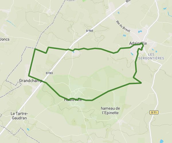
This running route covers 8.702mi starting from Bazemont, Yvelines. The run is a loop trail and returns to the trailhead. This run is rated as hard, expect about 1h33m to complete it. The route has an elevation gain of 285ft and an elevation loss of 328ft.
Première sortie
Route details
5.62mph
Speed
1063 kcal
Calories burned
Loop trail
Route type
207ft
Min altitude
512ft
Max altitude
Route profile
285ft
Elevation gain
328ft
Elevation loss
207ft
Min altitude
512ft
Max altitude
How to get there
Trailhead: Chemin De Meulan À Maule, 78410 Bazemont, France
GPS coordinates of the trailhead: 48.9369, 1.85363 / 48°56'12'' N, 1°51'13'' E