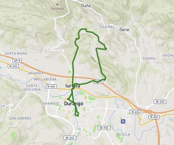
This hiking trail covers 7.664mi starting from Durango, Biscay. The hike is a loop trail and returns to the trailhead. This hike is rated as moderate, plan for about 2h15m to complete it. The route has an elevation gain of 587ft and an elevation loss of 584ft.
Gaztelua
Route details
3.41mph
Speed
968 kcal
Calories burned
2.9%
Avg grade
Loop trail
Route type
381ft
Min altitude
659ft
Max altitude
Route profile
587ft
Elevation gain
584ft
Elevation loss
381ft
Min altitude
659ft
Max altitude
How to get there
Trailhead: Artekalea, 48200 Durango
GPS coordinates of the trailhead: 43.16709, -2.63162 / 43°10'1'' N, 2°37'53'' W