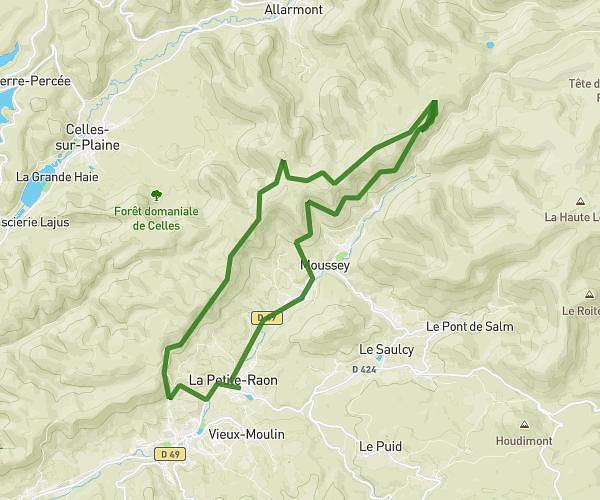
This running route covers 3.503mi starting from Hattigny, Moselle. The run is a loop trail and returns to the trailhead. This run is rated as easy, expect about 50m to complete it. The route has an elevation gain of 538ft and an elevation loss of 538ft.
Center Parc - Les trois forêts - Hattigny
Route details
4.21mph
Speed
572 kcal
Calories burned
Loop trail
Route type
961ft
Min altitude
1191ft
Max altitude
Route profile
538ft
Elevation gain
538ft
Elevation loss
961ft
Min altitude
1191ft
Max altitude
How to get there
Trailhead: Allée Des Cottages 607 À 658, 57790 Hattigny, France
GPS coordinates of the trailhead: 48.62497, 6.99165 / 48°37'29'' N, 6°59'29'' E