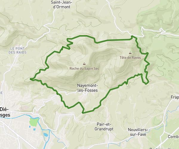
This running route covers 17.646mi starting from La Petite-Raon, Vosges. The run does not return to the trailhead and ends near Rue Du Centre, 88210 La Petite-Raon. This run is rated as strenuous, expect about 2h50m to complete it. The route has an elevation gain of 1552ft and an elevation loss of 1575ft.
balade roche du coquin
Route details
6.23mph
Speed
1944 kcal
Calories burned
Point to point
Route type
1010ft
Min altitude
2585ft
Max altitude
Route profile
1552ft
Elevation gain
1575ft
Elevation loss
1010ft
Min altitude
2585ft
Max altitude
How to get there
Trailhead: Rue Suzanne Goeppel, 88210 La Petite-Raon
GPS coordinates of the trailhead: 48.40559, 6.99724 / 48°24'20'' N, 6°59'50'' E