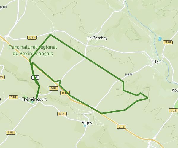
This running route covers 4.209mi starting from Bouffémont, Val-d'Oise. The run is a loop trail and returns to the trailhead. This run is rated as easy, expect about 45m to complete it. The route has an elevation gain of 413ft and an elevation loss of 417ft.
Bouffemont
Route details
5.61mph
Speed
515 kcal
Calories burned
Loop trail
Route type
413ft
Min altitude
663ft
Max altitude
Route profile
413ft
Elevation gain
417ft
Elevation loss
413ft
Min altitude
663ft
Max altitude
How to get there
Trailhead: 121 Rue De La République, 95570 Bouffémont, France
GPS coordinates of the trailhead: 49.042481, 2.298309 / 49°2'32'' N, 2°17'53'' E