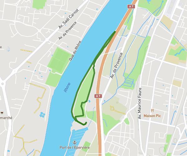
This walking route covers 1.854mi starting from Guilherand-Granges, Ardèche. The walk is a loop trail and returns to the trailhead. This walk is rated as easy, plan for about 33m to complete it. The route has an elevation gain of 52ft and an elevation loss of 52ft.
Parcours 4
Route details
17:47/mi
Pace
135 kcal
Calories burned
Loop trail
Route type
367ft
Min altitude
387ft
Max altitude
Route profile
52ft
Elevation gain
52ft
Elevation loss
367ft
Min altitude
387ft
Max altitude
How to get there
Trailhead: Rue Jacques Cartier, 07500 Guilherand-Granges, France
GPS coordinates of the trailhead: 44.93635, 4.86998 / 44°56'10'' N, 4°52'11'' E