MapPlanner
4.524mi
Distance
1h37m
Duration
21:27/mi
Pace
Easy
Level

marennes

Route details

2.8mph
Speed
1109 kcal
Calories burned
Loop trail
Route type
607ft
Min altitude
719ft
Max altitude

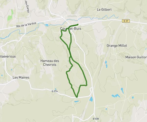
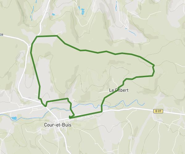
This running route covers 4.524mi starting from Chaponnay, Rhône. The run is a loop trail and returns to the trailhead. This run is rated as easy, expect about 1h37m to complete it. The route has an elevation gain of 148ft and an elevation loss of 148ft.

Route profile

148ft
Elevation gain
148ft
Elevation loss
607ft
Min altitude
719ft
Max altitude

How to get there

Trailhead: Rue Centrale, 69970 Chaponnay

GPS coordinates of the trailhead: 45.62725, 4.93511 / 45°37'38'' N, 4°56'6'' E

Caution: May Cross Private Property

This route may pass through or near private property. Always respect posted signs, obtain permission where required, and follow local trespassing laws. MapPlanner does not guarantee public access along any route.

Safety Notice

Trail and road conditions may change without notice due to weather, construction, or other factors. Always verify current conditions before heading out. You are responsible for your own safety — follow local signage, obey traffic laws, and use your best judgment on the trail.