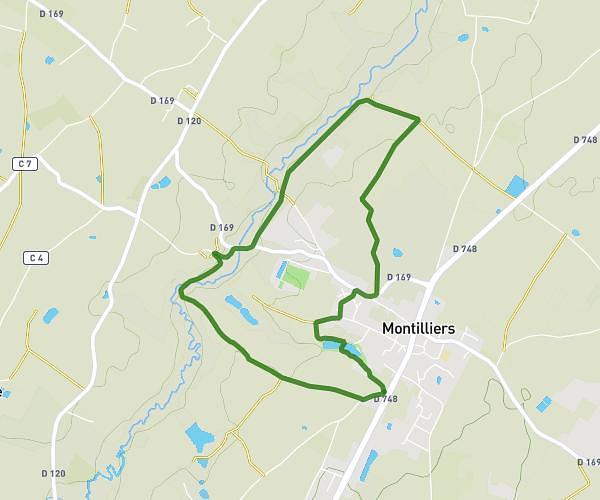
This hiking trail covers 3.401mi starting from Lys-Haut-Layon, Maine-et-Loire. The hike is a loop trail and returns to the trailhead. This hike is rated as easy, plan for about 1h to complete it. The route has an elevation gain of 210ft and an elevation loss of 210ft.
Vihiers "L'ORGERIE"
Route details
3.4mph
Speed
428 kcal
Calories burned
2.3%
Avg grade
Loop trail
Route type
230ft
Min altitude
364ft
Max altitude
Route profile
210ft
Elevation gain
210ft
Elevation loss
230ft
Min altitude
364ft
Max altitude
How to get there
Trailhead: Rue Du Voide, 49310 Lys-Haut-Layon
GPS coordinates of the trailhead: 47.14612, -0.53819 / 47°8'46'' N, 0°32'17'' W