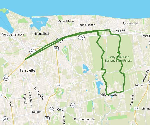
This cycling route covers 11.555mi starting from Middle Island, New York. The ride does not return to the trailhead and ends near 4935 Nesconset-Port Jefferson Highway, Port Jefferson Station, New York 11776, United States. This route is rated as easy, plan for about 1h10m to complete it. The route has an elevation gain of 112ft and an elevation loss of 23ft.
Poonerat
Route details
614 kcal
Calories burned
0.2%
Avg grade
Point to point
Route type
89ft
Min altitude
177ft
Max altitude
Route profile
112ft
Elevation gain
23ft
Elevation loss
89ft
Min altitude
177ft
Max altitude
How to get there
Trailhead: 90 Renaissance Boulevard, Middle Island, New York 11953, United States
GPS coordinates of the trailhead: 40.88856, -72.94136 / 40°53'18'' N, 72°56'28'' W