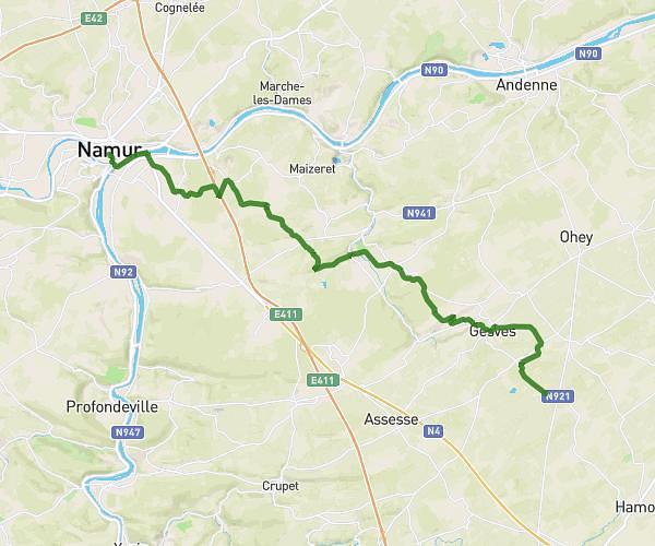
This running route covers 8.019mi starting from Hamois, Namur. The run is a loop trail and returns to the trailhead. This run is rated as hard, expect about 1h10m to complete it. The route has an elevation gain of 630ft and an elevation loss of 633ft.
Jogging du Plateau de Frisée 2023 13 Kms
Route details
6.84mph
Speed
805 kcal
Calories burned
Loop trail
Route type
853ft
Min altitude
1014ft
Max altitude
Route profile
630ft
Elevation gain
633ft
Elevation loss
853ft
Min altitude
1014ft
Max altitude
How to get there
Trailhead: Rue Des Papillons 23, 5364 Hamois, Namur, Belgium
GPS coordinates of the trailhead: 50.37206, 5.13045 / 50°22'19'' N, 5°7'49'' E