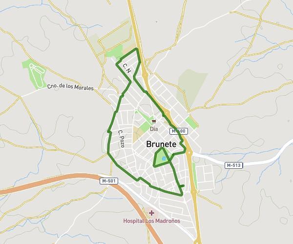
This running route covers 2.948mi starting from Brunete, Madrid. The run does not return to the trailhead and ends near Calle San Mateo 1, 28690 Brunete, Madrid, Spain. This run is rated as easy, expect about 30m38s to complete it. The route has an elevation gain of 148ft and an elevation loss of 135ft.
Parque brunete
Route details
5.77mph
Speed
350 kcal
Calories burned
Point to point
Route type
2123ft
Min altitude
2149ft
Max altitude
Route profile
148ft
Elevation gain
135ft
Elevation loss
2123ft
Min altitude
2149ft
Max altitude
How to get there
Trailhead: Calle De La Caridad 18, 28690 Brunete, Madrid, Spain
GPS coordinates of the trailhead: 40.404628, -3.997991 / 40°24'16'' N, 3°59'52'' W