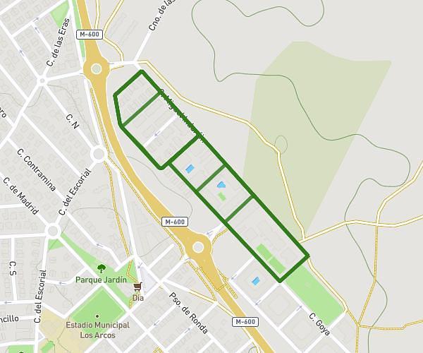
This running route covers 2.861mi starting from Villanueva de la Cañada, Madrid. The run does not return to the trailhead and ends near Camino De La Raya 26, 28691 Brunete, Madrid, Spain. This run is rated as easy, expect about 31m4s to complete it. The route has an elevation gain of 154ft and an elevation loss of 177ft.
Ruta Villanueva-Raya
Route details
5.52mph
Speed
355 kcal
Calories burned
Point to point
Route type
2096ft
Min altitude
2152ft
Max altitude
Route profile
154ft
Elevation gain
177ft
Elevation loss
2096ft
Min altitude
2152ft
Max altitude
How to get there
Trailhead: Calle Magnolio 1, 28691 Villanueva de la Cañada, Madrid, Spain
GPS coordinates of the trailhead: 40.450434, -4.00202 / 40°27'1'' N, 4°0'7'' W