MapPlanner
2.066mi
Distance
1h6m
Duration
32:11/mi
Pace
Moderate
Level

Au fil de l'eau

Route details

32:11/mi
Pace
272 kcal
Calories burned
Point to point
Route type
36ft
Min altitude
62ft
Max altitude

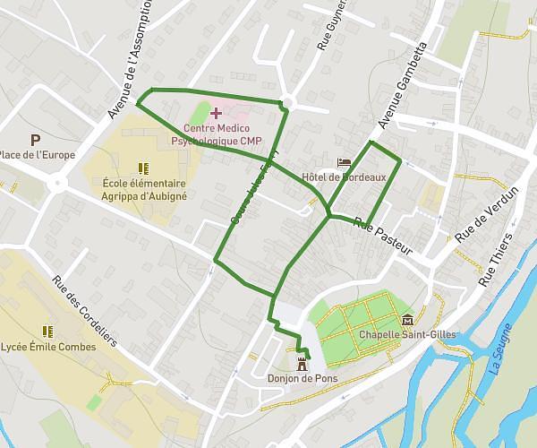
This walking route covers 2.066mi starting from Pons, Charente-Maritime. The walk does not return to the trailhead and ends near Rue De La Piscine, 17800 Pons. This walk is rated as moderate, plan for about 1h6m to complete it. The route has an elevation gain of 75ft and an elevation loss of 69ft.

Description of the route by the creator

The aim of this trail is to bring a little freshness and well-being to the banks of the Seugne, also known as the "Little Green Venice". You'll also have the chance to discover the flora and fauna of our city.

(Description automatically translated)

Route profile

75ft
Elevation gain
69ft
Elevation loss
36ft
Min altitude
62ft
Max altitude

How to get there

Trailhead: D 732, 17800 Pons

GPS coordinates of the trailhead: 45.57294, -0.54726 / 45°34'22'' N, 0°32'50'' W

Caution: May Cross Private Property

This route may pass through or near private property. Always respect posted signs, obtain permission where required, and follow local trespassing laws. MapPlanner does not guarantee public access along any route.

Safety Notice

Trail and road conditions may change without notice due to weather, construction, or other factors. Always verify current conditions before heading out. You are responsible for your own safety — follow local signage, obey traffic laws, and use your best judgment on the trail.