MapPlanner
1.57mi
Distance
50m31s
Duration
32:11/mi
Pace
Easy
Level

Au fil du temps

Route details

32:11/mi
Pace
206 kcal
Calories burned
Point to point
Route type
43ft
Min altitude
105ft
Max altitude

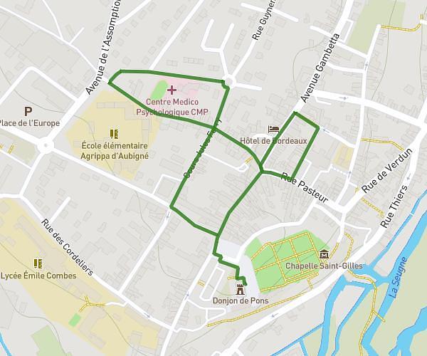
This walking route covers 1.57mi starting from Pons, Charente-Maritime. The walk does not return to the trailhead and ends near Église Saint-Vivien, 17800 Pons. This walk is rated as easy, plan for about 50m31s to complete it. The route has an elevation gain of 108ft and an elevation loss of 157ft.

Description of the route by the creator

This tour will take you back in time to discover UNESCO's heritage.

(Description automatically translated)

Route profile

108ft
Elevation gain
157ft
Elevation loss
43ft
Min altitude
105ft
Max altitude

How to get there

Trailhead: Donjon de Pons, 17800 Pons

GPS coordinates of the trailhead: 45.57814, -0.54756 / 45°34'41'' N, 0°32'51'' W

Caution: May Cross Private Property

This route may pass through or near private property. Always respect posted signs, obtain permission where required, and follow local trespassing laws. MapPlanner does not guarantee public access along any route.

Safety Notice

Trail and road conditions may change without notice due to weather, construction, or other factors. Always verify current conditions before heading out. You are responsible for your own safety — follow local signage, obey traffic laws, and use your best judgment on the trail.