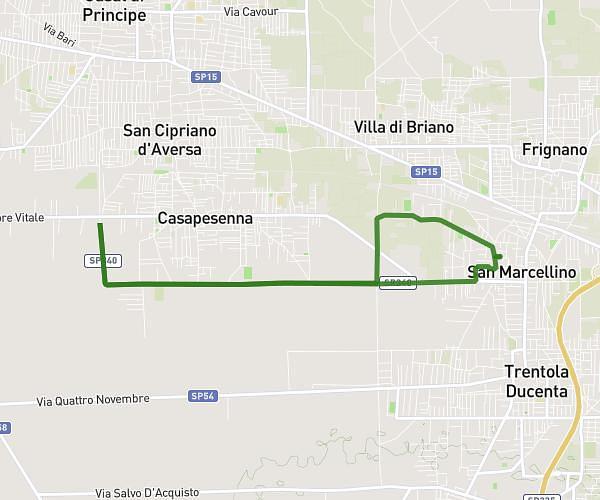
This walking route covers 4.399mi starting from San Marcellino, Caserta. The walk is a loop trail and returns to the trailhead. This walk is rated as moderate, plan for about 4h8m to complete it. The route has an elevation gain of 108ft and an elevation loss of 108ft.
1 percorso
Route details
56:28/mi
Pace
1013 kcal
Calories burned
Loop trail
Route type
98ft
Min altitude
125ft
Max altitude
Route profile
108ft
Elevation gain
108ft
Elevation loss
98ft
Min altitude
125ft
Max altitude
How to get there
Trailhead: Via Delle Gardenie, 81030 San Marcellino
GPS coordinates of the trailhead: 40.98855, 14.17271 / 40°59'18'' N, 14°10'21'' E