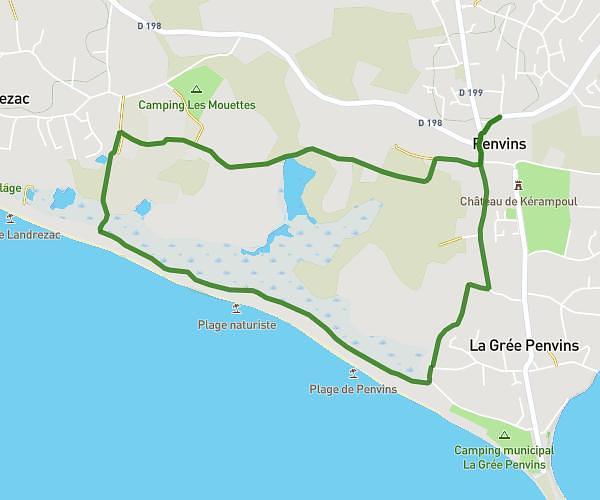
This walking route covers 1.117mi starting from Sarzeau, Morbihan. The walk is a loop trail and returns to the trailhead. This walk is rated as easy, plan for about 1h to complete it. The route has an elevation gain of 39ft and an elevation loss of 39ft.
Suscinio marais
Route details
53:39/mi
Pace
245 kcal
Calories burned
Loop trail
Route type
0ft
Min altitude
23ft
Max altitude
Route profile
39ft
Elevation gain
39ft
Elevation loss
0ft
Min altitude
23ft
Max altitude
How to get there
Trailhead: 14 Rue De Kerglomirec, 56370 Sarzeau, France
GPS coordinates of the trailhead: 47.51158, -2.72869 / 47°30'41'' N, 2°43'43'' W