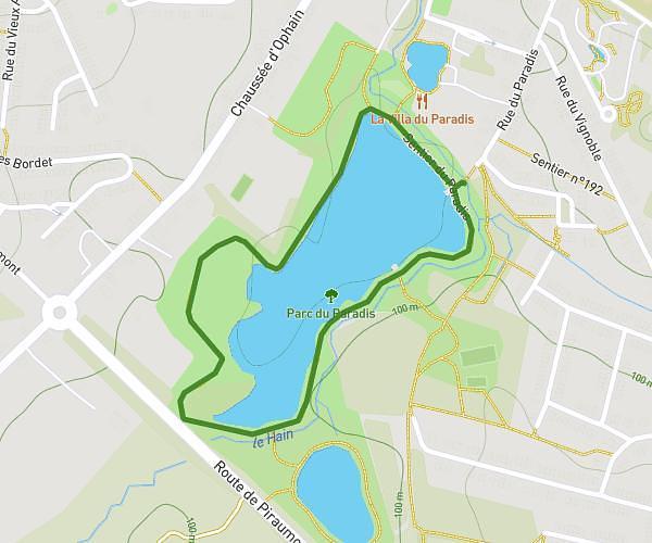
This running route covers 4.976mi starting from Saint-Gilles, Brussels-Capital. The run is a loop trail and returns to the trailhead. This run is rated as moderate, expect about 1h3s to complete it. The route has an elevation gain of 279ft and an elevation loss of 276ft.
8km
Route details
4.97mph
Speed
687 kcal
Calories burned
Loop trail
Route type
262ft
Min altitude
407ft
Max altitude
Route profile
279ft
Elevation gain
276ft
Elevation loss
262ft
Min altitude
407ft
Max altitude
How to get there
Trailhead: Avenue Jef Lambeaux - Jef Lambeauxlaan 16, 1060 Saint-Gilles, Brussels-Capital, Belgium
GPS coordinates of the trailhead: 50.82375, 4.34628 / 50°49'25'' N, 4°20'46'' E