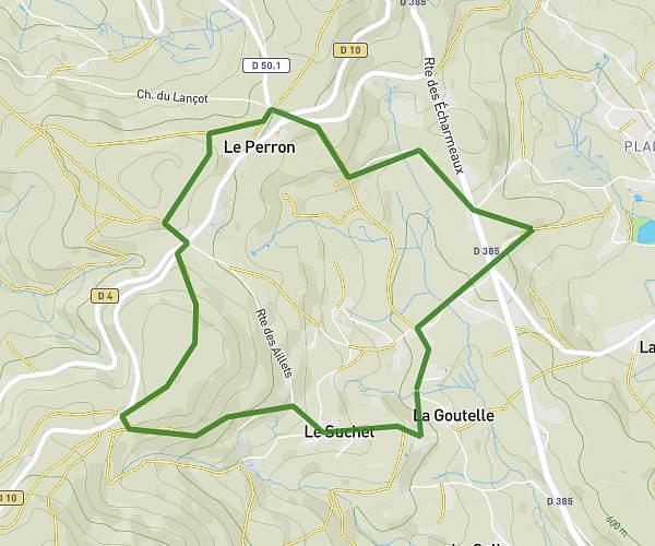
This running route covers 2.923mi starting from Châteauneuf, Saône-et-Loire. The run is a loop trail and returns to the trailhead. This run is rated as easy, expect about 1h20m to complete it. The route has an elevation gain of 308ft and an elevation loss of 285ft.
Chateauneuf église tancon
Route details
2.19mph
Speed
915 kcal
Calories burned
Loop trail
Route type
958ft
Min altitude
1266ft
Max altitude
Route profile
308ft
Elevation gain
285ft
Elevation loss
958ft
Min altitude
1266ft
Max altitude
How to get there
Trailhead: Rue Gensoul, 71740 Châteauneuf
GPS coordinates of the trailhead: 46.21267, 4.2547 / 46°12'45'' N, 4°15'16'' E