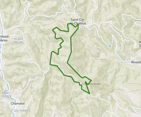
This hiking trail covers 3.736mi starting from Propières, Rhône. The hike is a loop trail and returns to the trailhead. This hike is rated as moderate, plan for about 1h37m to complete it. The route has an elevation gain of 840ft and an elevation loss of 840ft.
Croix d'Ajoux
Route details
2.31mph
Speed
727 kcal
Calories burned
8.5%
Avg grade
Loop trail
Route type
2123ft
Min altitude
2812ft
Max altitude
Steep climb
Route profile
840ft
Elevation gain
840ft
Elevation loss
2123ft
Min altitude
2812ft
Max altitude
How to get there
Trailhead: 190 Place Du Belvédère, 69790 Propières, France
GPS coordinates of the trailhead: 46.19197, 4.4384 / 46°11'31'' N, 4°26'18'' E