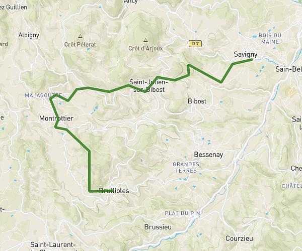
This hiking trail covers 4.065mi starting from Ronno, Rhône. The hike is a loop trail and returns to the trailhead. This hike is rated as moderate, plan for about 1h30m to complete it. The route has an elevation gain of 866ft and an elevation loss of 840ft.
Allongement parcours Lac des Sapins
Route details
2.71mph
Speed
672 kcal
Calories burned
7.9%
Avg grade
Loop trail
Route type
1660ft
Min altitude
2283ft
Max altitude
Route profile
866ft
Elevation gain
840ft
Elevation loss
1660ft
Min altitude
2283ft
Max altitude
How to get there
Trailhead: Chemin De La Croix De Montagny, 69550 Ronno, France
GPS coordinates of the trailhead: 46.00489, 4.388236 / 46°0'17'' N, 4°23'17'' E