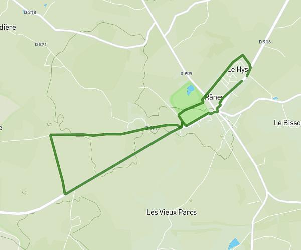
This running route covers 3.733mi starting from Briouze, Orne. The run is a loop trail and returns to the trailhead. This run is rated as easy, expect about 40m to complete it. The route has an elevation gain of 213ft and an elevation loss of 213ft.
6km INFINYTHON #3
Route details
5.6mph
Speed
457 kcal
Calories burned
Loop trail
Route type
656ft
Min altitude
719ft
Max altitude
Route profile
213ft
Elevation gain
213ft
Elevation loss
656ft
Min altitude
719ft
Max altitude
How to get there
Trailhead: 8 Place Du Général De Gaulle, 61220 Briouze, France
GPS coordinates of the trailhead: 48.698088, -0.368041 / 48°41'53'' N, 0°22'4'' W