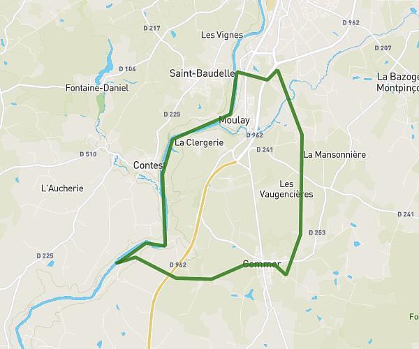
This running route covers 12.402mi starting from Sainte-Marie-du-Bois, Mayenne. The run does not return to the trailhead and ends near Route Forestière De L'épinette, 61600 La Ferté Macé, France. This run is rated as strenuous, expect about 2h13m to complete it. The route has an elevation gain of 853ft and an elevation loss of 705ft.
Viré moto
Route details
5.59mph
Speed
1521 kcal
Calories burned
Point to point
Route type
371ft
Min altitude
696ft
Max altitude
Route profile
853ft
Elevation gain
705ft
Elevation loss
371ft
Min altitude
696ft
Max altitude
How to get there
Trailhead: 6 La Guyonniere, 53110 Sainte-Marie-du-Bois, France
GPS coordinates of the trailhead: 48.472639, -0.505436 / 48°28'21'' N, 0°30'19'' W