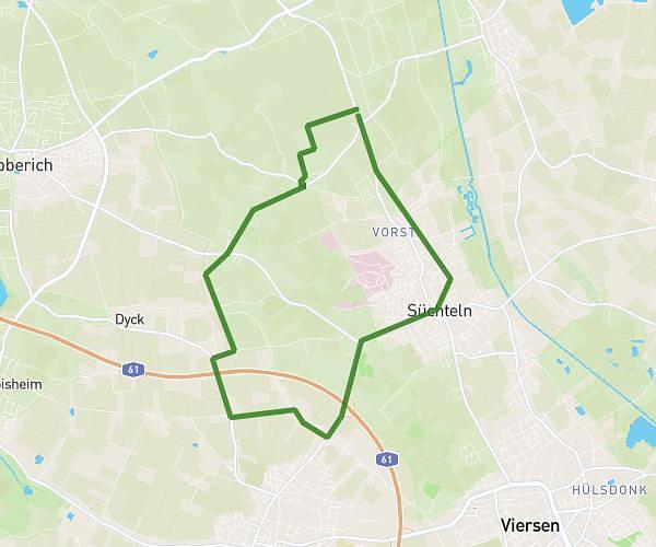
This running route covers 3.821mi starting from Neuss, North Rhine-Westphalia. The run is a loop trail and returns to the trailhead. This run is rated as easy, expect about 41m to complete it. The route has an elevation gain of 16ft and an elevation loss of 23ft.
Neuss kurz
Route details
5.59mph
Speed
469 kcal
Calories burned
Loop trail
Route type
121ft
Min altitude
138ft
Max altitude
Route profile
16ft
Elevation gain
23ft
Elevation loss
121ft
Min altitude
138ft
Max altitude
How to get there
Trailhead: Nordkanalallee 40, 41464 Neuss, Germany
GPS coordinates of the trailhead: 51.191911, 6.695034 / 51°11'30'' N, 6°41'42'' E