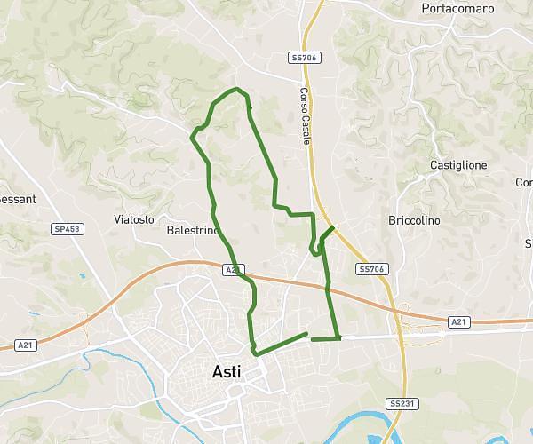
This running route covers 7.927mi starting from Asti, Asti. The run is a loop trail and returns to the trailhead. This run is rated as hard, expect about 1h25m to complete it. The route has an elevation gain of 236ft and an elevation loss of 210ft.
Viattosto
Route details
5.59mph
Speed
972 kcal
Calories burned
Loop trail
Route type
351ft
Min altitude
587ft
Max altitude
Route profile
236ft
Elevation gain
210ft
Elevation loss
351ft
Min altitude
587ft
Max altitude
How to get there
Trailhead: Corso Alessandria 275, 14100 Asti Asti, Italy
GPS coordinates of the trailhead: 44.905569, 8.226342 / 44°54'20'' N, 8°13'34'' E