MapPlanner
11.344mi
Distance
6h5m
Duration
+3442ft
Elevation gain
-3694ft
Elevation loss
Strenuous
Level

Dolomite - Etape 5

Route details

1.86mph
Speed
2801 kcal
Calories burned
11.9%
Avg grade
Point to point
Route type
Steep climb

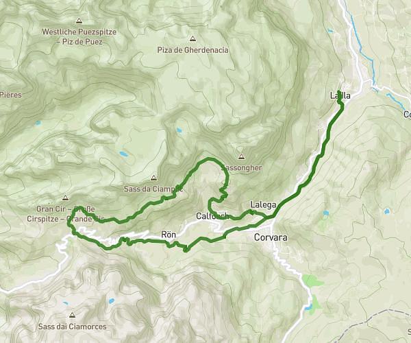
This hiking trail covers 11.344mi starting from Marebbe, South Tyrol. The hike does not return to the trailhead and ends near 39036 Badia. This hike is rated as strenuous, plan for about 6h5m to complete it. The route has an elevation gain of 3442ft and an elevation loss of 3694ft.

Route profile

3442ft
Elevation gain
3694ft
Elevation loss

How to get there

Trailhead: Fodara Vedla, 39030 Marebbe

GPS coordinates of the trailhead: 46.64362, 12.05836 / 46°38'37'' N, 12°3'30'' E

Caution: May Cross Private Property

This route may pass through or near private property. Always respect posted signs, obtain permission where required, and follow local trespassing laws. MapPlanner does not guarantee public access along any route.

Safety Notice

Trail and road conditions may change without notice due to weather, construction, or other factors. Always verify current conditions before heading out. You are responsible for your own safety — follow local signage, obey traffic laws, and use your best judgment on the trail.