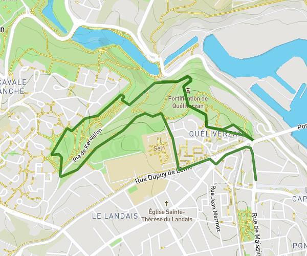
This running route covers 4.822mi starting from Brélès, Finistère. The run is a loop trail and returns to the trailhead. This run is rated as easy, expect about 52m to complete it. The route has an elevation gain of 164ft and an elevation loss of 98ft.
Entraînement pour kervalon à Brélès
Route details
5.57mph
Speed
595 kcal
Calories burned
Loop trail
Route type
72ft
Min altitude
184ft
Max altitude
Route profile
164ft
Elevation gain
98ft
Elevation loss
72ft
Min altitude
184ft
Max altitude
How to get there
Trailhead: 18 Rue Al Lannog, 29810 Brélès, France
GPS coordinates of the trailhead: 48.474681, -4.707823 / 48°28'28'' N, 4°42'28'' W