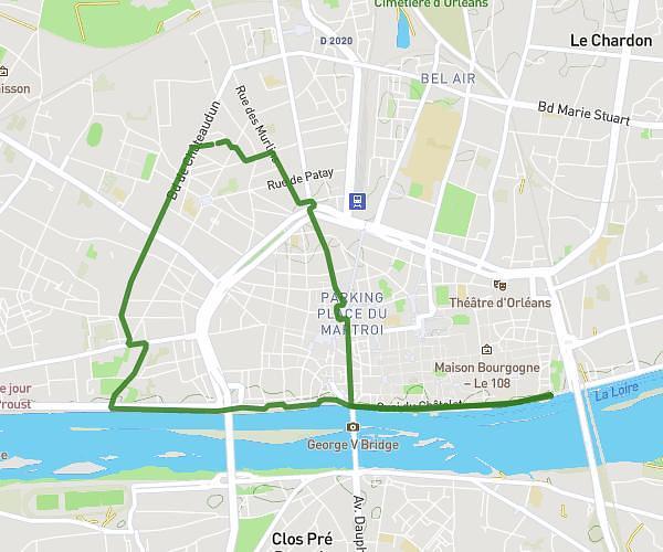
This running route covers 4.873mi starting from Orléans, Loiret. The run is a loop trail and returns to the trailhead. This run is rated as easy, expect about 1h1s to complete it. The route has an elevation gain of 295ft and an elevation loss of 302ft.
Ce soir
Route details
4.87mph
Speed
686 kcal
Calories burned
Loop trail
Route type
285ft
Min altitude
390ft
Max altitude
Route profile
295ft
Elevation gain
302ft
Elevation loss
285ft
Min altitude
390ft
Max altitude
How to get there
Trailhead: 2a Rue Henri Duvillard, 45000 Orléans, France
GPS coordinates of the trailhead: 47.909236, 1.888804 / 47°54'33'' N, 1°53'19'' E