MapPlanner
2.965mi
Distance
31m48s
Duration
10:44/mi
Pace
Easy
Level

XIBALBA 5 km

INVITATION FLAYER
INVITATION FLAYER
AWARDS
AWARDS
REGISTRATION QR
REGISTRATION QR
ROUTE
ROUTE
DELIVERY OF NUMBERS
DELIVERY OF NUMBERS

Route details

5.59mph
Speed
364 kcal
Calories burned
Loop trail
Route type
1781ft
Min altitude
1854ft
Max altitude

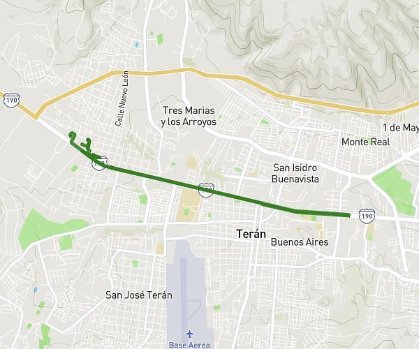
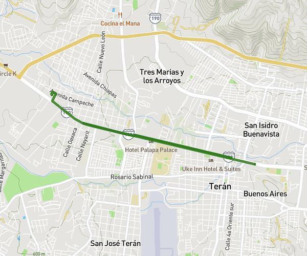
This running route covers 2.965mi starting from Tuxtla Gutiérrez, Chiapas. The run is a loop trail and returns to the trailhead. This run is rated as easy, expect about 31m48s to complete it. The route has an elevation gain of 95ft and an elevation loss of 95ft.

Description of the route by the creator

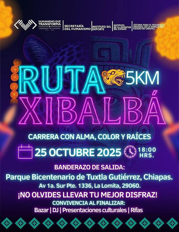
6 JUDGES START AND FINISH 4 JUDGES EN ROUTE 4 JUDGES ON RETURN 3 HYDRATION POINTS KM 1.8 -- KM 3.6 AND FINISH LINE 1 AMBULANCE AT START AND FINISH (PC. RED CROSS) 1 AMBULANCE IN TRANSIT 8000 WATERS OF 325 ML.

(Description automatically translated)

Route profile

95ft
Elevation gain
95ft
Elevation loss
1781ft
Min altitude
1854ft
Max altitude

How to get there

Trailhead: Avenida 1a Sur Poniente 1489, 29060 Tuxtla Gutiérrez, Chiapas, Mexico

GPS coordinates of the trailhead: 16.754472, -93.129444 / 16°45'16'' N, 93°7'45'' W

Caution: May Cross Private Property

This route may pass through or near private property. Always respect posted signs, obtain permission where required, and follow local trespassing laws. MapPlanner does not guarantee public access along any route.

Safety Notice

Trail and road conditions may change without notice due to weather, construction, or other factors. Always verify current conditions before heading out. You are responsible for your own safety — follow local signage, obey traffic laws, and use your best judgment on the trail.