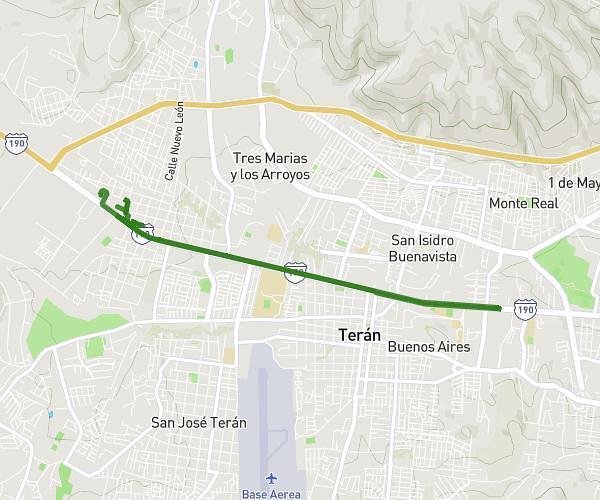
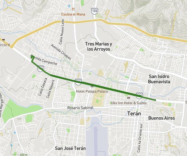
This running route covers 0.529mi starting from Tuxtla Gutiérrez, Chiapas. The run is a loop trail and returns to the trailhead. This run is rated as easy, expect about 6m to complete it. The route has an elevation gain of 16ft and an elevation loss of 16ft.
XIBALBA KIDS


Route details
5.29mph
Speed
69 kcal
Calories burned
Loop trail
Route type
1785ft
Min altitude
1798ft
Max altitude
Route profile
16ft
Elevation gain
16ft
Elevation loss
1785ft
Min altitude
1798ft
Max altitude
How to get there
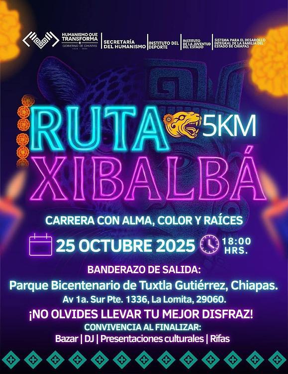
Trailhead: Avenida 1a Sur Poniente 1489, 29060 Tuxtla Gutiérrez, Chiapas, Mexico
GPS coordinates of the trailhead: 16.754486, -93.129434 / 16°45'16'' N, 93°7'45'' W