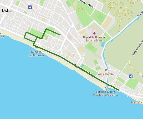
This running route covers 2.908mi starting from Roma, Rome. The run does not return to the trailhead and ends near Piazza Del Popolo 17, 00187 Roma Rome, Italy. This run is rated as easy, expect about 31m to complete it. The route has an elevation gain of 240ft and an elevation loss of 344ft.
Roma
Route details
5.63mph
Speed
354 kcal
Calories burned
Point to point
Route type
59ft
Min altitude
190ft
Max altitude
Route profile
240ft
Elevation gain
344ft
Elevation loss
59ft
Min altitude
190ft
Max altitude
How to get there
Trailhead: Via Giovanni Giolitti 164, 00185 Roma Rome, Italy
GPS coordinates of the trailhead: 41.894098, 12.51143 / 41°53'38'' N, 12°30'41'' E