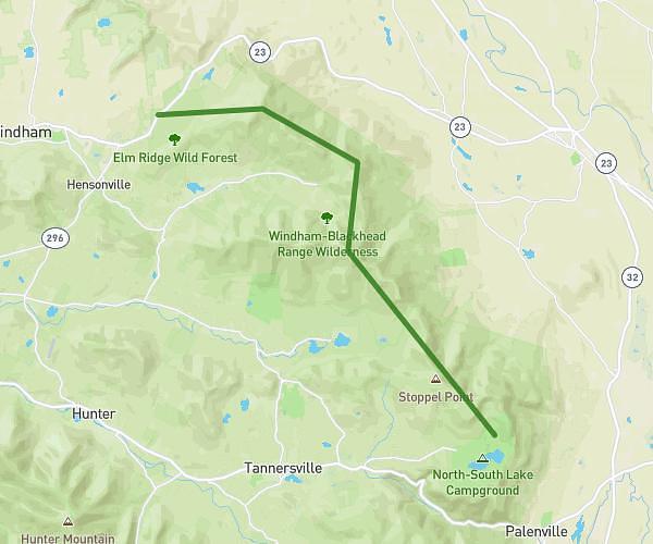
This hiking trail covers 8.558mi starting from Haines Falls, New York. The hike is a loop trail and returns to the trailhead. This hike is rated as hard, plan for about 2h13m to complete it. The route has an elevation gain of 2067ft and an elevation loss of 2073ft.
Escarpment Day 2
Route details
3.85mph
Speed
1004 kcal
Calories burned
9.2%
Avg grade
Loop trail
Route type
1867ft
Min altitude
2759ft
Max altitude
Steep climb
Route profile
2067ft
Elevation gain
2073ft
Elevation loss
1867ft
Min altitude
2759ft
Max altitude
How to get there
Trailhead: 825 North Lake Road, Haines Falls, New York 12485, United States
GPS coordinates of the trailhead: 42.201817, -74.058023 / 42°12'6'' N, 74°3'28'' W