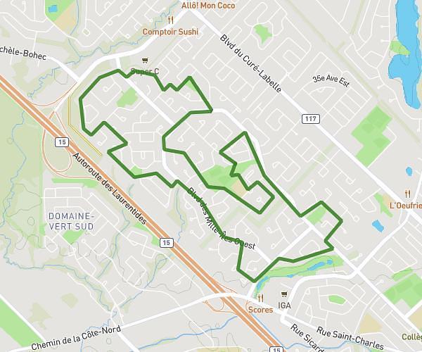
This running route covers 5.955mi starting from Rosemère, Quebec. The run does not return to the trailhead and ends near 629 Rue Des Vignobles, Rosemère, Quebec J7A 4K8, Canada. This run is rated as moderate, expect about 1h4m to complete it. The route has an elevation gain of 203ft and an elevation loss of 220ft.
COURSE ROSEMERE
Route details
5.58mph
Speed
732 kcal
Calories burned
Point to point
Route type
75ft
Min altitude
112ft
Max altitude
Route profile
203ft
Elevation gain
220ft
Elevation loss
75ft
Min altitude
112ft
Max altitude
How to get there
Trailhead: 180 Rue Jean, Rosemère, Quebec J7A 2S5, Canada
GPS coordinates of the trailhead: 45.632274, -73.7933 / 45°37'56'' N, 73°47'35'' W