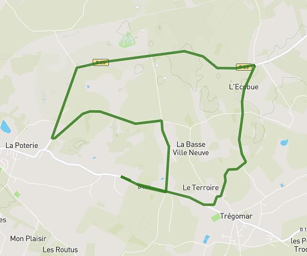
This running route covers 3.13mi starting from Plumaugat, Côtes-d'Armor. The run does not return to the trailhead and ends near 2 Launay Chene Poisson, 22250 Plumaugat, France. This run is rated as easy, expect about 21m26s to complete it. The route has an elevation gain of 62ft and an elevation loss of 154ft.
Lundi après matchs
Route details
8.76mph
Speed
245 kcal
Calories burned
Point to point
Route type
318ft
Min altitude
472ft
Max altitude
Route profile
62ft
Elevation gain
154ft
Elevation loss
318ft
Min altitude
472ft
Max altitude
How to get there
Trailhead: 13 La Fleunais, 22250 Plumaugat, France
GPS coordinates of the trailhead: 48.269642, -2.25432 / 48°16'10'' N, 2°15'15'' W