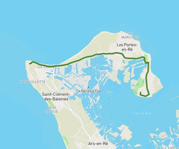
This cycling route covers 5.056mi starting from Saint-Clément-des-Baleines, Charente-Maritime. The ride does not return to the trailhead and ends near 14 Route Du Champ Cloppé, 17880 Les Portes-en-Ré, France. This route is rated as moderate, plan for about 54m14s to complete it. The route has an elevation gain of 144ft and an elevation loss of 138ft.
Phare à champ Cloppé
Route details
478 kcal
Calories burned
1.1%
Avg grade
Point to point
Route type
-10ft
Min altitude
10ft
Max altitude
Route profile
144ft
Elevation gain
138ft
Elevation loss
-10ft
Min altitude
10ft
Max altitude
How to get there
Trailhead: 8 Allée Du Phare, 17590 Saint-Clément-des-Baleines, France
GPS coordinates of the trailhead: 46.243292, -1.55919 / 46°14'35'' N, 1°33'33'' W