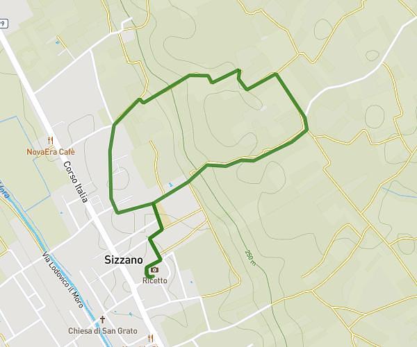
This running route covers 6.47mi starting from Sizzano, Novara. The run is a loop trail and returns to the trailhead. This run is rated as moderate, expect about 1h9m to complete it. The route has an elevation gain of 640ft and an elevation loss of 640ft.
Pasquetta 2026
Route details
5.59mph
Speed
794 kcal
Calories burned
Loop trail
Route type
725ft
Min altitude
912ft
Max altitude
Route profile
640ft
Elevation gain
640ft
Elevation loss
725ft
Min altitude
912ft
Max altitude
How to get there
Trailhead: Piazza Biagio Prone 3, 28070 Sizzano Novara, Italy
GPS coordinates of the trailhead: 45.576951, 8.438647 / 45°34'37'' N, 8°26'19'' E