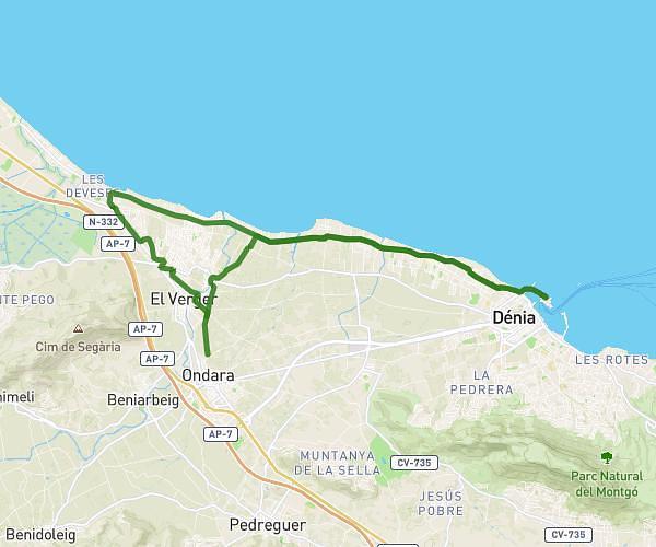
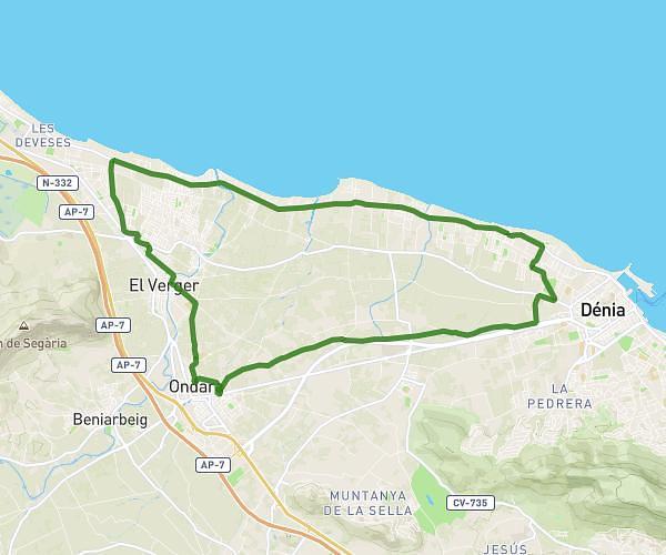
This running route covers 13.635mi starting from Ondara, Alicante. The run is a loop trail and returns to the trailhead. This run is rated as strenuous, expect about 1h35m to complete it. The route has an elevation gain of 390ft and an elevation loss of 394ft.
ruta 21 km
Route details
8.61mph
Speed
1086 kcal
Calories burned
Loop trail
Route type
-3ft
Min altitude
112ft
Max altitude
Route profile
390ft
Elevation gain
394ft
Elevation loss
-3ft
Min altitude
112ft
Max altitude
How to get there
Trailhead: Camí Dels Poblets, 03760 Ondara, Alicante, Spain
GPS coordinates of the trailhead: 38.83248, 0.017 / 38°49'56'' N, 0°1'1'' E