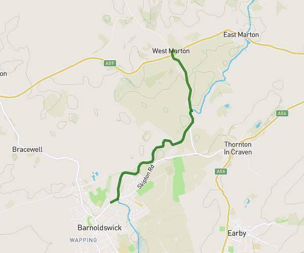
This walking route covers 3.07mi starting from Skipton, England. The walk does not return to the trailhead and ends near 1 Crownest Cottages, Barnoldswick, BB18 5RR, United Kingdom. This walk is rated as easy, plan for about 1h14m to complete it. The route has an elevation gain of 177ft and an elevation loss of 269ft.
Barnoldswick on canal
Route details
24:08/mi
Pace
303 kcal
Calories burned
Point to point
Route type
453ft
Min altitude
571ft
Max altitude
Route profile
177ft
Elevation gain
269ft
Elevation loss
453ft
Min altitude
571ft
Max altitude
How to get there
Trailhead: 20 Gledstone Road, West Marton, Skipton, BD23 3UE, United Kingdom
GPS coordinates of the trailhead: 53.951038, -2.163227 / 53°57'3'' N, 2°9'47'' W