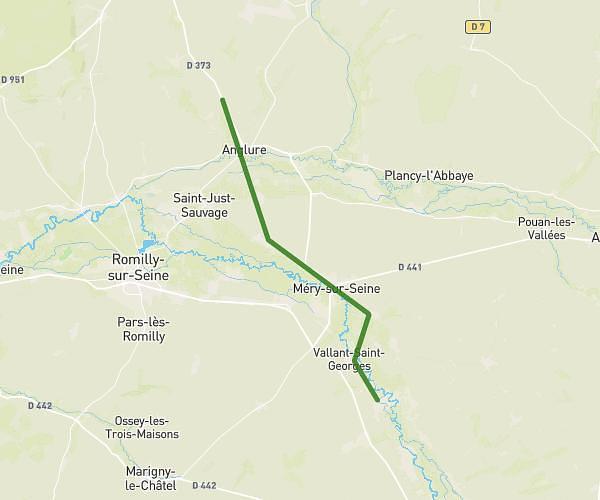
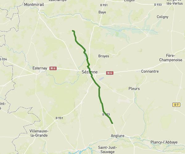
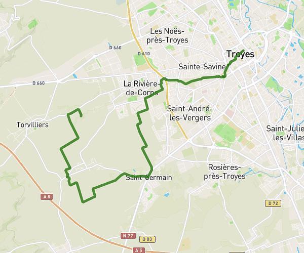
This hiking trail covers 16.013mi starting from Saint-Mesmin, Aube. The hike does not return to the trailhead and ends near D 373, 51260 Allemanche-Launay-et-Soyer, France. This hike is rated as moderate, plan for about 5h10m to complete it. The route has an elevation gain of 187ft and an elevation loss of 230ft.
1etape charleville
Route details
3.1mph
Speed
2178 kcal
Calories burned
0.5%
Avg grade
Point to point
Route type
233ft
Min altitude
289ft
Max altitude
Route profile
187ft
Elevation gain
230ft
Elevation loss
233ft
Min altitude
289ft
Max altitude
How to get there
Trailhead: 53 Rue De Chily, 10280 Saint-Mesmin, France
GPS coordinates of the trailhead: 48.446521, 3.925511 / 48°26'47'' N, 3°55'31'' E