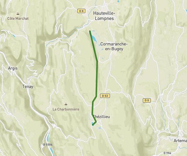
This running route covers 8.006mi starting from Plateau d'Hauteville, Ain. The run does not return to the trailhead and ends near 13 Rue Du Pré Mollard, 01510 La Burbanche, France. This run is rated as hard, expect about 1h24m to complete it. The route has an elevation gain of 453ft and an elevation loss of 1982ft.
Cascade Burbanche
Route details
5.72mph
Speed
960 kcal
Calories burned
Point to point
Route type
1194ft
Min altitude
3120ft
Max altitude
Route profile
453ft
Elevation gain
1982ft
Elevation loss
1194ft
Min altitude
3120ft
Max altitude
How to get there
Trailhead: Chemin Du Camping, 01110 Plateau d'Hauteville, France
GPS coordinates of the trailhead: 45.886603, 5.587119 / 45°53'11'' N, 5°35'13'' E