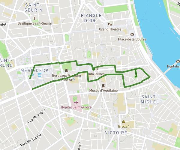
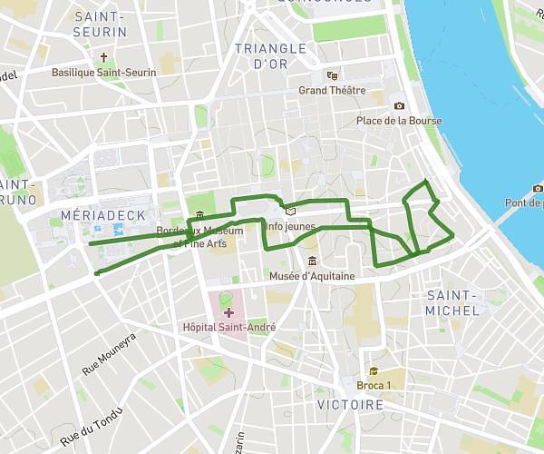
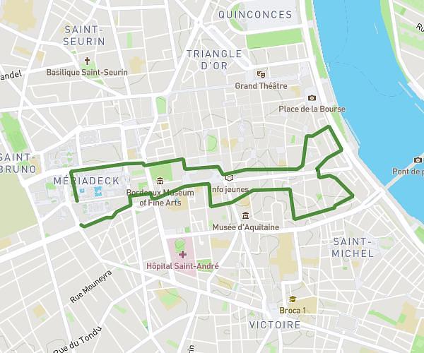
This walking route covers 1.586mi starting from Bordeaux, Gironde. The walk does not return to the trailhead and ends near 24 Quai Lawton, 33300 Bordeaux, France. This walk is rated as easy, plan for about 35m to complete it. The route has an elevation gain of 13ft and an elevation loss of 20ft.
Cité du vin BAF
Route details
22:06/mi
Pace
143 kcal
Calories burned
Point to point
Route type
7ft
Min altitude
20ft
Max altitude
Route profile
13ft
Elevation gain
20ft
Elevation loss
7ft
Min altitude
20ft
Max altitude
How to get there
Trailhead: 1 Pont Tournant, 33000 Bordeaux, France
GPS coordinates of the trailhead: 44.86238, -0.55006 / 44°51'44'' N, 0°33'0'' W