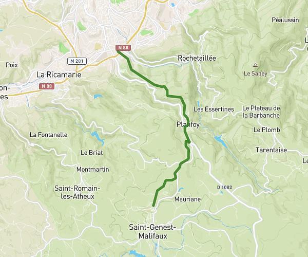
This running route covers 5.078mi starting from Chambœuf, Loire. The run is a loop trail and returns to the trailhead. This run is rated as moderate, expect about 54m4s to complete it. The route has an elevation gain of 535ft and an elevation loss of 538ft.
Roseraie
Route details
5.64mph
Speed
618 kcal
Calories burned
Loop trail
Route type
1198ft
Min altitude
1463ft
Max altitude
Route profile
535ft
Elevation gain
538ft
Elevation loss
1198ft
Min altitude
1463ft
Max altitude
How to get there
Trailhead: 139 Allée Des Châtaigniers, 42330 Chambœuf, France
GPS coordinates of the trailhead: 45.573386, 4.32434 / 45°34'24'' N, 4°19'27'' E