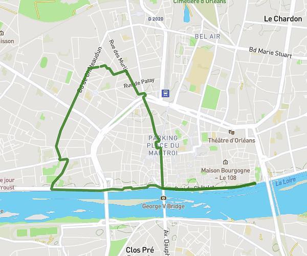
This running route covers 2.604mi starting from Meung-sur-Loire, Loiret. The run is a loop trail and returns to the trailhead. This run is rated as easy, expect about 28m to complete it. The route has an elevation gain of 16ft and an elevation loss of 46ft.
Meung
Route details
5.58mph
Speed
320 kcal
Calories burned
Loop trail
Route type
282ft
Min altitude
328ft
Max altitude
Route profile
16ft
Elevation gain
46ft
Elevation loss
282ft
Min altitude
328ft
Max altitude
How to get there
Trailhead: 8 Place Du Martroi, 45130 Meung-sur-Loire, France
GPS coordinates of the trailhead: 47.824335, 1.694751 / 47°49'27'' N, 1°41'41'' E