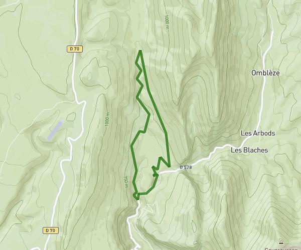
This hiking trail covers 3.682mi starting from Crest, Drôme. The hike is a loop trail and returns to the trailhead. This hike is rated as hard, plan for about 1h58m to complete it. The route has an elevation gain of 938ft and an elevation loss of 938ft.
Boucle Crest 5,9 km
Route details
1.86mph
Speed
896 kcal
Calories burned
9.7%
Avg grade
Loop trail
Route type
610ft
Min altitude
1342ft
Max altitude
Steep climb
Route profile
938ft
Elevation gain
938ft
Elevation loss
610ft
Min altitude
1342ft
Max altitude
How to get there
Trailhead: Pont Frédéric Mistral, 26400 Crest, France
GPS coordinates of the trailhead: 44.726653, 5.021167 / 44°43'35'' N, 5°1'16'' E