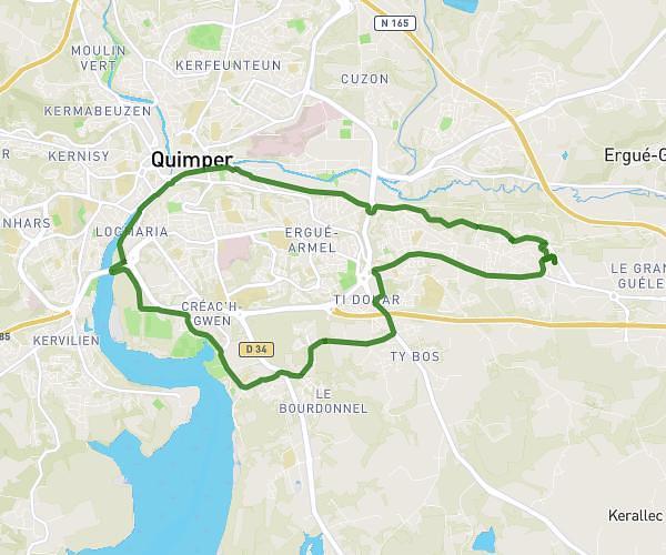
This cycling route covers 10.993mi starting from Ploudaniel, Finistère. The ride is a loop trail and returns to the trailhead. This route is rated as easy, plan for about 1h6m to complete it. The route has an elevation gain of 85ft and an elevation loss of 89ft.
1er test
Route details
579 kcal
Calories burned
0.3%
Avg grade
Loop trail
Route type
213ft
Min altitude
292ft
Max altitude
Route profile
85ft
Elevation gain
89ft
Elevation loss
213ft
Min altitude
292ft
Max altitude
How to get there
Trailhead: 8 Kerviniour Ar Parcou, 29260 Ploudaniel, France
GPS coordinates of the trailhead: 48.51903, -4.35345 / 48°31'8'' N, 4°21'12'' W