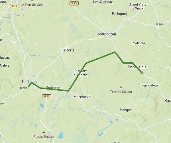
This hiking trail covers 7.675mi starting from La Fage-Montivernoux, Lozère. The hike is a loop trail and returns to the trailhead. This hike is rated as moderate, plan for about 1h9m to complete it. The route has an elevation gain of 817ft and an elevation loss of 820ft.
projet marche gourmande 2025
Route details
6.67mph
Speed
499 kcal
Calories burned
4.0%
Avg grade
Loop trail
Route type
3766ft
Min altitude
4140ft
Max altitude
Route profile
817ft
Elevation gain
820ft
Elevation loss
3766ft
Min altitude
4140ft
Max altitude
How to get there
Trailhead: Impasse De La Fontaine Des Fours, 48310 La Fage-Montivernoux
GPS coordinates of the trailhead: 44.73607, 3.16709 / 44°44'9'' N, 3°10'1'' E