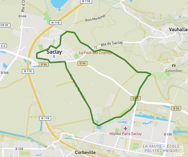
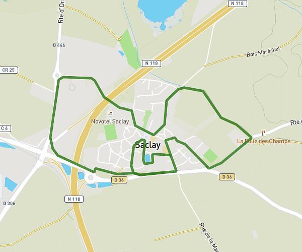
This running route covers 4.223mi starting from Les Clayes-sous-Bois, Yvelines. The run is a loop trail and returns to the trailhead. This run is rated as easy, expect about 45m to complete it. The route has an elevation gain of 105ft and an elevation loss of 121ft.
6.8km
Route details
5.63mph
Speed
515 kcal
Calories burned
Loop trail
Route type
354ft
Min altitude
476ft
Max altitude
Route profile
105ft
Elevation gain
121ft
Elevation loss
354ft
Min altitude
476ft
Max altitude
How to get there
Trailhead: 14 Rue Jean Monnet, 78340 Les Clayes-sous-Bois, France
GPS coordinates of the trailhead: 48.818703, 1.974703 / 48°49'7'' N, 1°58'28'' E