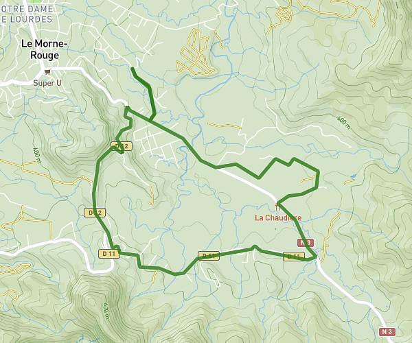
This running route covers 5.32mi starting from Le Morne-Rouge, Martinique. The run is a loop trail and returns to the trailhead. This run is rated as moderate, expect about 57m to complete it. The route has an elevation gain of 377ft and an elevation loss of 200ft.
Morne-Rouge 7,5 Km
Route details
5.6mph
Speed
652 kcal
Calories burned
Loop trail
Route type
1184ft
Min altitude
1440ft
Max altitude
Route profile
377ft
Elevation gain
200ft
Elevation loss
1184ft
Min altitude
1440ft
Max altitude
How to get there
Trailhead: 992 Rue Paulette Nardal, 97260, Le Morne-Rouge, Martinique
GPS coordinates of the trailhead: 14.772216, -61.126003 / 14°46'19'' N, 61°7'33'' W